Introduction to California Tidepools
Tidal Cycles
The most important thing in planning a tidepool trip is to schedule it for as low a tide as possible. This can be done with tide books and tide calendars (available at most dive shops and sporting goods stores). Most areas on Earth, including Santa Barbara, have two tidal cycles each day created by forces in our universe, primarily from the moon and sun. A high/low cycle is followed by another high/low cycle - really on a 25-hour sequence so tides will change their time daily, getting about an hour later each day. In most areas, the two cycles are of unequal height. In a 25-hour period there will be a high high tide (over five feet above sea level). This high tide will be followed by the lowest low tide (the average of which we call zero, or sea level). Then there will be a second high tide, which averages five feet in Santa Barbara. This is called the low high tide. Finally there will be another low tide, averaging two and a half feet above sea level, in Santa Barbara. This is called the high low tide.
Although these names may seem tricky, their key heights create "zones" of horizontal stripes (bands) in the rocky intertidal that have very different environments as far as dryness goes.
Horizontal Bands - the Zones
Greater than five feet above sea level, the surface of a rocky shoreline in Southern California is covered only by the highest high tide and thus dry three-quarters of the day. We call this the "Splash" Zone. Then, between five feet and two and a half feet, the surface is covered alternately by both high tides so it is dry between the high tides - about half a day. This band is called the "High Tide" Zone. Between sea level and two and a half feet the rocks are only left dry at the low low tide. This area is thus dry only a quarter of each average day and called the "Mid Tide" Zone. Then there is what we call the "Low Tide" Zone … the area below sea level that is exposed for only a few hours every few weeks at special "minus" tides (remember, zero sea level is the average of the low low tides). These zones are sometimes called zone 1 (splash), zone 2 (high), zone 3 (mid), and zone 4 (low). These special "minus" tides are the perfect time to go tidepooling and you can plan your trip, using a tide book, knowing that the tide will be very much the same for an hour before and an hour after each predicted tide. You usually have a good two hours to enjoy a nice low tide.
As the water goes down, most of the critters go out with it, but some can't move and are left on rocks. These critters must be adapted to withstand, not only the dryness of their area, but waves, storms, wind and rain. Each zone has what I call its "indicators"; species I know will always be there, in the Santa Barbara tidepools, no matter what. There are three critters in the Splash Zone, three in the High Tide Zone, one in the Mid Tide Zone, and thousands in the Low Tide Zone (I call these the "treasures" but only three can be considered "indicators"). It is their ability to withstand dryness, and their interactions with each other (eating, being eaten, competing for space, and reproducing) that determine who dominates within the rocky intertidal areas.
This lesson is about the "indicators" of the upper three zones and then a little about my favorite "treasures" from the diverse Low Tide Zone. The photographic images transport us to local tidepools. The pictures were taken on the Santa Barbara coastline, between Goleta and Carpinteria. They begin with an overview of the two best tidepool areas near Santa Barbara - Coal Oil Point and Carpinteria State Park.
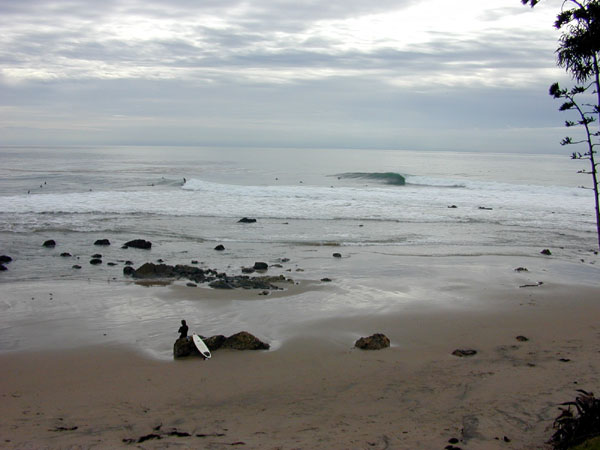
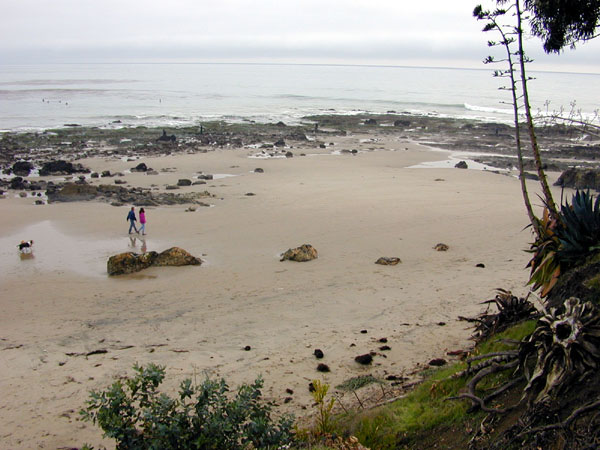
At Coal Oil Point (also called Devereux Point) in Goleta, just up the coast from Santa Barbara, California, the rocky shore is more like a boulder field with many small turnable rocks providing a variety of habitats. When the water level is at high tide the tidepool area is not even noticeable, but at low tide the various sized rocks attract tidepoolers.
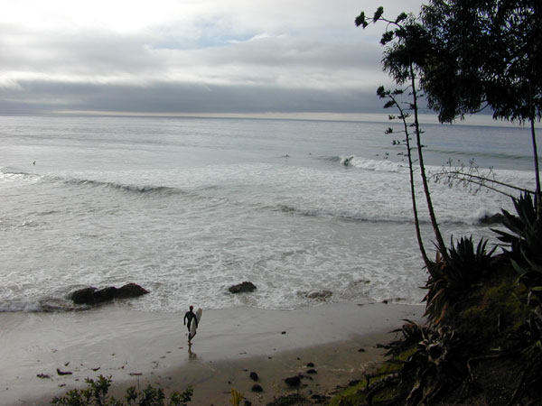
Devereux Point at high tide (above) (GA image)
Devereux Point as the tide is ebbing (above) (GA image)
Devereux Point at low tide with tidepool boulder field exposed (above) (GA image)
Down the coast from Santa Barbara, at Carpinteria State Park, the more massive, vertical bedrock faces of the rocky shore (with few turnable rocks) provide a concise look at the four zones. A small area of Splash Zone with its three indicator species (a snail, a limpet and a tiny barnacle) can be found high on the largest rocks.
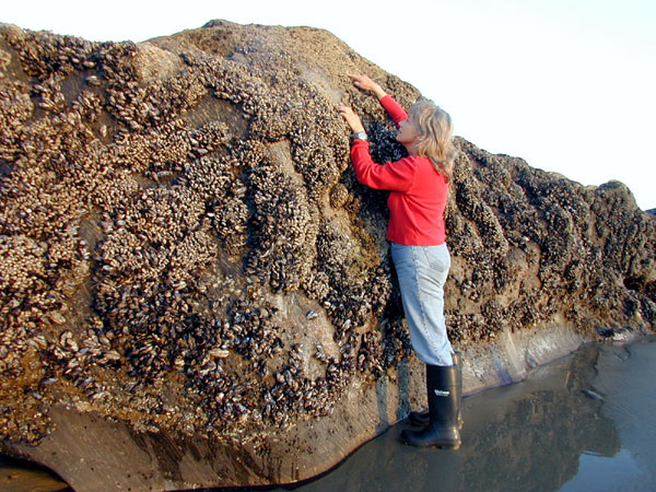
The author, Genny, looking at the Splash Zone at Carpinteria State Park (above) (GA image)
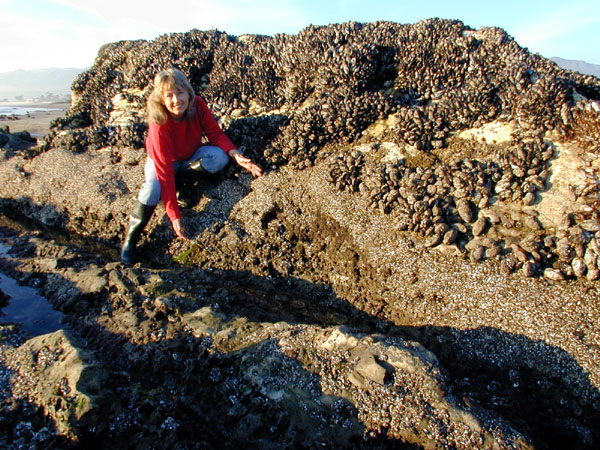
The High Tide Zone with its three indicators (two other barnacles and a mussel) and the Mid Tide Zone (with its one indicator species, an anemone) are well represented in the middle and lower portions of these massive rock outcroppings.
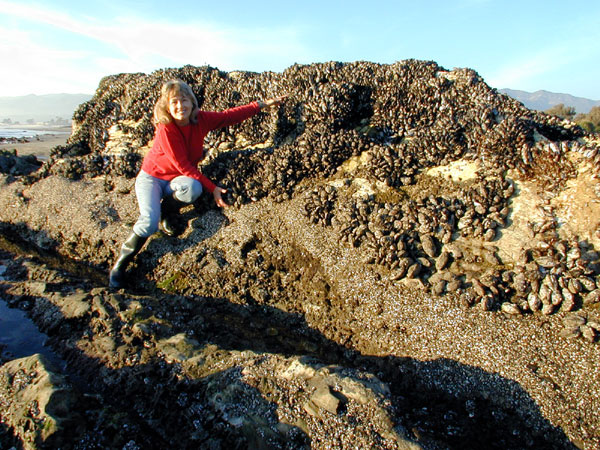
The author, Genny, showing the High Tide Zone at Carpinteria State Park (above) (GA image)
The author, Genny, showing the Mid Tide Zone at Carpinteria State Park (above) (GA image)
The Low Tide Zone (with three indicators - a plant, sea stars and another anemone, then all the thousands of treasures that can be found below the water) is only accessible at extreme minus tides.
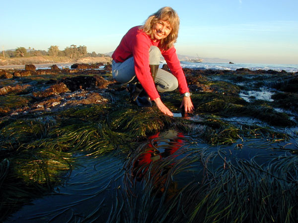
The author, Genny, showing the Low Tide Zone at Carpinteria State Park (above) (GA image) |
|
